Wells Gray Tours is a local Kamloops company which has been providing quality packaged travel since 1972. My cousin Ann, a mutual friend, Daryth and I booked a 6 day trip into BC inlets and sounds (known on the tour as fjords).
The great fjords of the British Columbia Coast rival those of Norway in length and depth but have even higher mountain scenery with a more alpine flavour. Many of the islands offshore are much larger than those along the Norwegian coast, many large enough to have major fjords of their own, as well as their own mountain ranges.
Highlights of our trip included Knight Inlet, BC's longest fjord, Cascade Falls & Chatterbox Falls, Grizzly Bear viewing at Glendale River, Nakwakto Tidal Rapids, Desolation Sound and Princess Louisa Fjord.
I can say this was another wonderful Wells Grey Tours experience.
Monday, June 6, 2016 Into the unknown – Northern
Vancouver Island
We were picked up in South
Nanaimo at about 11 and found our tour guide was Lisa, a guide we have had before. She is wonderfully informative and both relaxed and able to bring us to order if needed. This will be a fun trip.
After a couple of
hours we reached Parksville where the Beach Club Resort offered us a meal of
yummy beef curry soup with tuna and veggie wraps. No room for dessert.
 |
| Our tour bus on the road to Parksville |
We walked off our meal with a nice long stroll along the beach in the sun and fresh sea air.
 |
| Beach - Parksville |
This was a vacation spot place my family and I came when I was a youngster - many memories of play time on the beach, hiding under logs, swimming in the shallow beach which seemed to go on forever.
 |
| Beach looking towards Vancouver Island Mountains |
After lunch we continued up the Island for a couple of
hours. The road traffic became sporadic,
the views expansive and the hemlock and fir trees became taller with less space
between them. Lisa, our super tour guide
gave us histories of the area and geographic features (Strathcona Park, the
Golden Hind mountain, Mt Washington, Mt Albert Edward, Forbidden Plateau).
After a coffee stop in Campbell River, we stopped at the
lookout over Seymour Narrows. Lisa reminded us this was
the location of an underground mountain (Ripple Rock) which, with the tidal
currents around it had been a hazard to navigation for hundreds of years. In order to improve safety for mariners,
after many attempts, its top was removed by a planned explosion on 5 April
1958. Over 1,200 metric tons of explosive was used and was one of the first
live coast-to-coast television broadcasts of an event in Canada 635,000 metric
tons of rock and water were displaced by the explosion, spewing debris at least
300 metres in the air which fell on land on either side of the narrows.
 |
| Ripple Rock planned explosion 1958 |
It looks rather calm in there now; however, you can still see the eddies and currents from the remains of the rock.
 |
| Seymour Narrows |
For the next two hours we continued up the Island. The views were magnificent with snow still evident on the tops of the mountains. Our destination certainly is a long way up Island.
 |
| Where we're going |
About quarter to 6 we arrived at the motel where we will stay for the next two nights and, after getting settled, hiked on down to a great pub (Guy's Bar and Grill) on the waterfront.
 |
| Port McNeil marina |
The fish and chips were among the nicest I have had. Fish which was probably still flipping about in the ocean a few hours earlier.
One of the pub's claims to fame is having a Jersey from Willie Mitchell, a Canadian professional ice hockey defenceman who currently serves as captain of the Florida Panthers. Of course, I had to take a photo.
 |
| NHL Willie Mitchell's jersey |
As we had an early morning start tomorrow to go into Queen Charlotte Straight we got an early night. The setting sun was a harbinger of a good day tomorrow.
 |
| Night night - with a great sunset |
Tuesday, June 7, 2016 – Queen Charlotte Straight and
Nakwatko Rapids.
We boarded the Naiad Explorer (owned and run by MacKay
Whale Watching) for the first of four exciting ocean experiences. Bill and Donna were extremely knowledgable and kept up a very informative chatter and history of the area.
 |
| Naiad Explorer and our tour guide, Lisa |
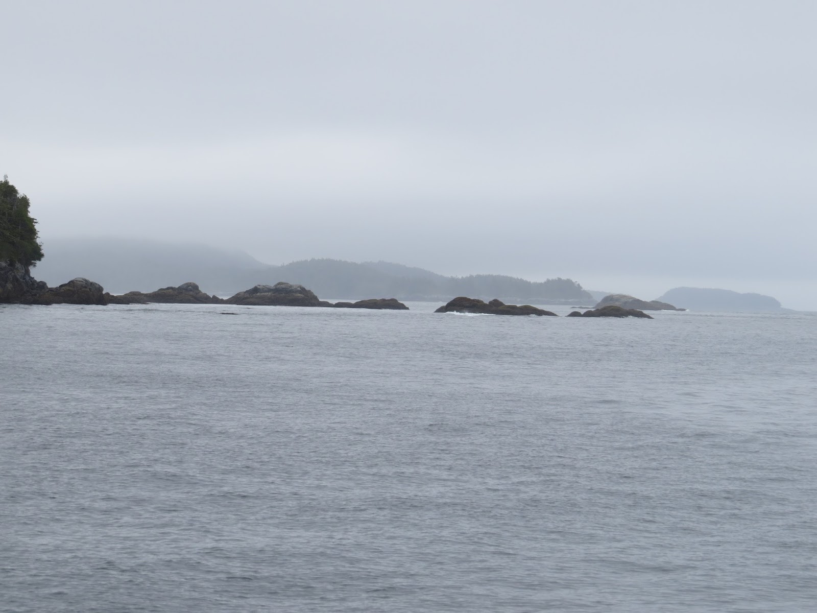
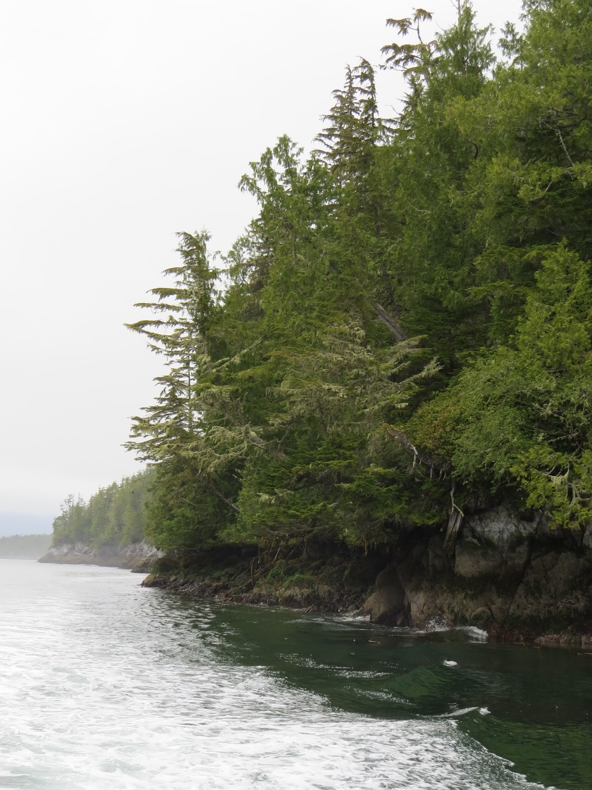
We cruised north across Queen Charlotte
Strait and Labouchere Passage towards the mainland.
 |
| Rocks and trees and seas |
 |
| Little lighthouse on our way |
 |
| Little Islands in Queen Charlotte Strait and Labouchere Passage |
 |
| Where we're going |
 |
| On our way - back view |
On our way, we saw rafts of otters and
interesting sea - vegetation interface.
 |
| Rafts of sea otters |
 |
| High water mark |
Today’s timing was important so we could experience the
thrilling tidal rush through the Nakwakto Rapids. Here the waters of Seymour
Inlet (58 km long) and Belize Inlet (40 km long) surge through the 300-metre
wide gap. With the benefit of the Naiad’s big engines, we cruised right into
the tidal flow and had a sensational vantage point as the usually calm ocean
comes to life like a giant rushing river.
 |
| Coming into the Rapids |
 |
| Closer view of coming into the Rapids |
The spectacle happens twice a day, but a combination of factors made
June 7 the second best day to experience the Nakwakto Rapids as the tide was
ebbing (flowing out of the fjords) and predicted to reach the awesome speed of
14.3 knots at 9 am (the fastest tide of the year is early on the day before).
These are the fastest tidal rapids in the world, according to Guinness.
 |
| In the middle of Nakwakto Rapids |
 |
| Little hole between two Islands |
 |
Boiling Rapids
The boiling waters collide with Turret Island, appropriately nicknamed Tremble Island. The rapids were discovered by explorers under the command of Captain Pender in 1865 and named for the local Indian tribe.
|
 |
| Rapids - Tremble Island |
 |
| Turret (Tremble) Island and water standing in current. |
Today’s voyage also included Wells Pass and Blunden
Harbour, made famous by an Emily Carr painting.
Passersby are allowed to go on the dock but not on the land
itself. There is a watchman to ensure this
requirement is met. At this point, our
Captain told us a bit about Kwakwaka'wakw nation First Nations history and
legends.
 |
| Effect of wind on vegetation |
We also passed some sea lions sunning themselves on a
small island and had a lovely early summer view of the sea and sky.
 |
| Sea Lions lounging |
 |
| Getting ready to battle over who is the top lion |
 |
| Beautiful sea and sky |
 |
| Beautiful sea and sky |
 |
| Views coming home |
After
viewing a magestic eagle looking to feed and the beautiful sea in which he lives,
 |
| Eagle looking for dinner |
 |
| Amazing sea colours |
we took a leisurely motor around Alert Bay and Yalis village
 |
| Coming into Alert Bay |
 |
| Totem Poles in Alert Bay |
 |
| Alert Bay |
 |
| Yalis - Port McNeil |
 |
| U'mista Cultural Centre - Yalis |
 |
| Where totems are carved. |
before we returned
to Port McNeill where we viewed the "World's largest burl".
When we arrived back we were all rather tired but after a
rest, we had dinner at the restaurant in the hotel - Northern Lights
Restaurant. I had a Caesar Salad with
pan fried Fanny Bay oysters. It was
absolutely delicious!!!
Wednesday, June 8, 2016 – High mountains rising
straight from water’s edge.
Our trip on the Naiad Explorer started out a but dull but
brightened up along the way as we bounced over open water to Knight Inlet, BC's
longest fjord at 113 km. Captain
Vancouver, during his 1792 expedition, was impressed with “the high stupendous
mountains rising perpendicularly from the water’s edge”.
We passed Crease Island (named after my great, great
grandfather) at the mouth of the inlet.
 |
| Crease Island |
The area we were in is called the Broughton Archipelago - well named, as
there are many, many little islands scattered over the stretch of open
sea.
 |
| Broughton Archipelago |
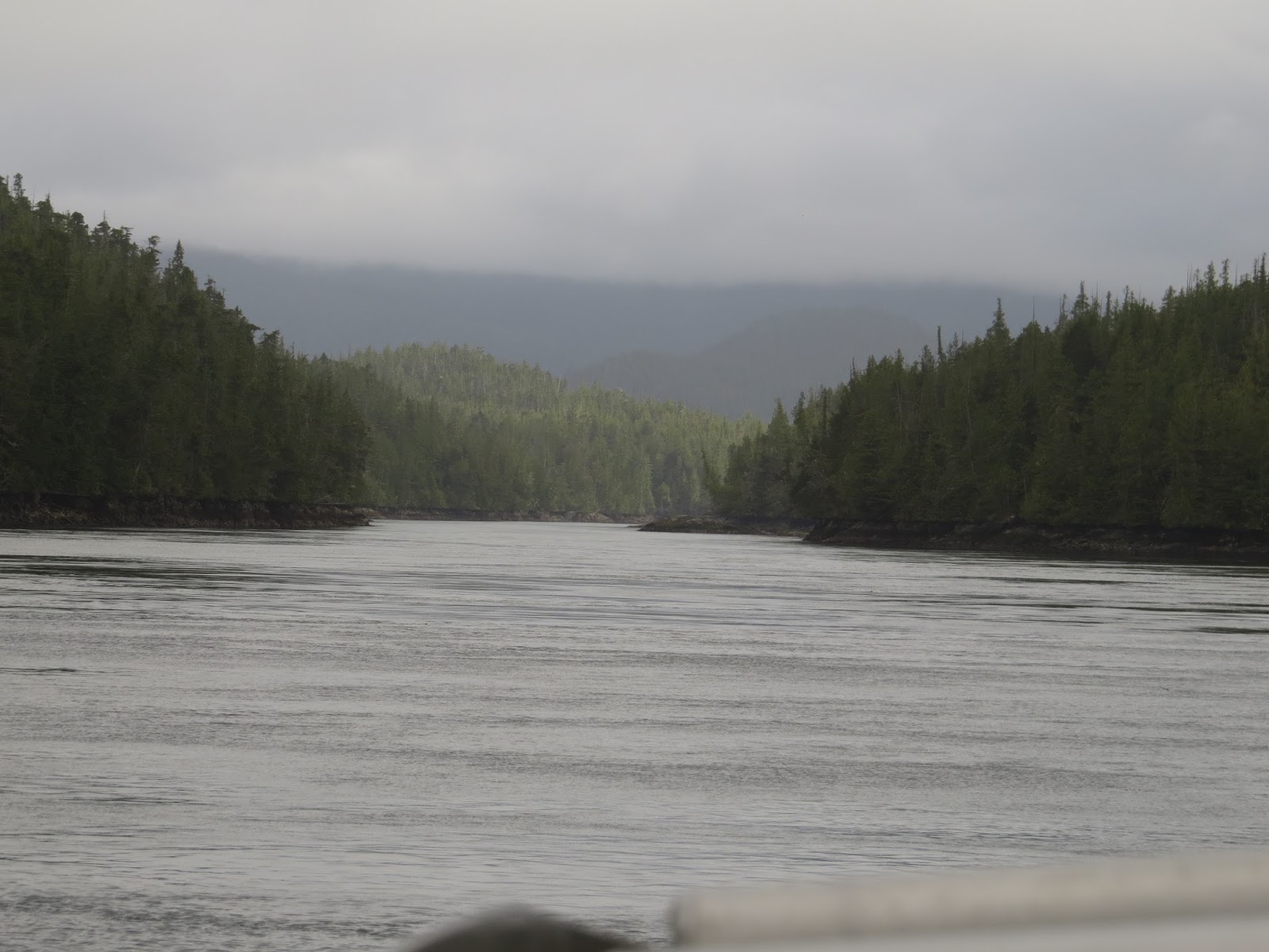
As we moved further up the inlet/fjord, the weather began
closing in. On our way we saw
considerable recent and historical landslide damage (likely natural geological
movement).
 |
| Evidence of landslides |
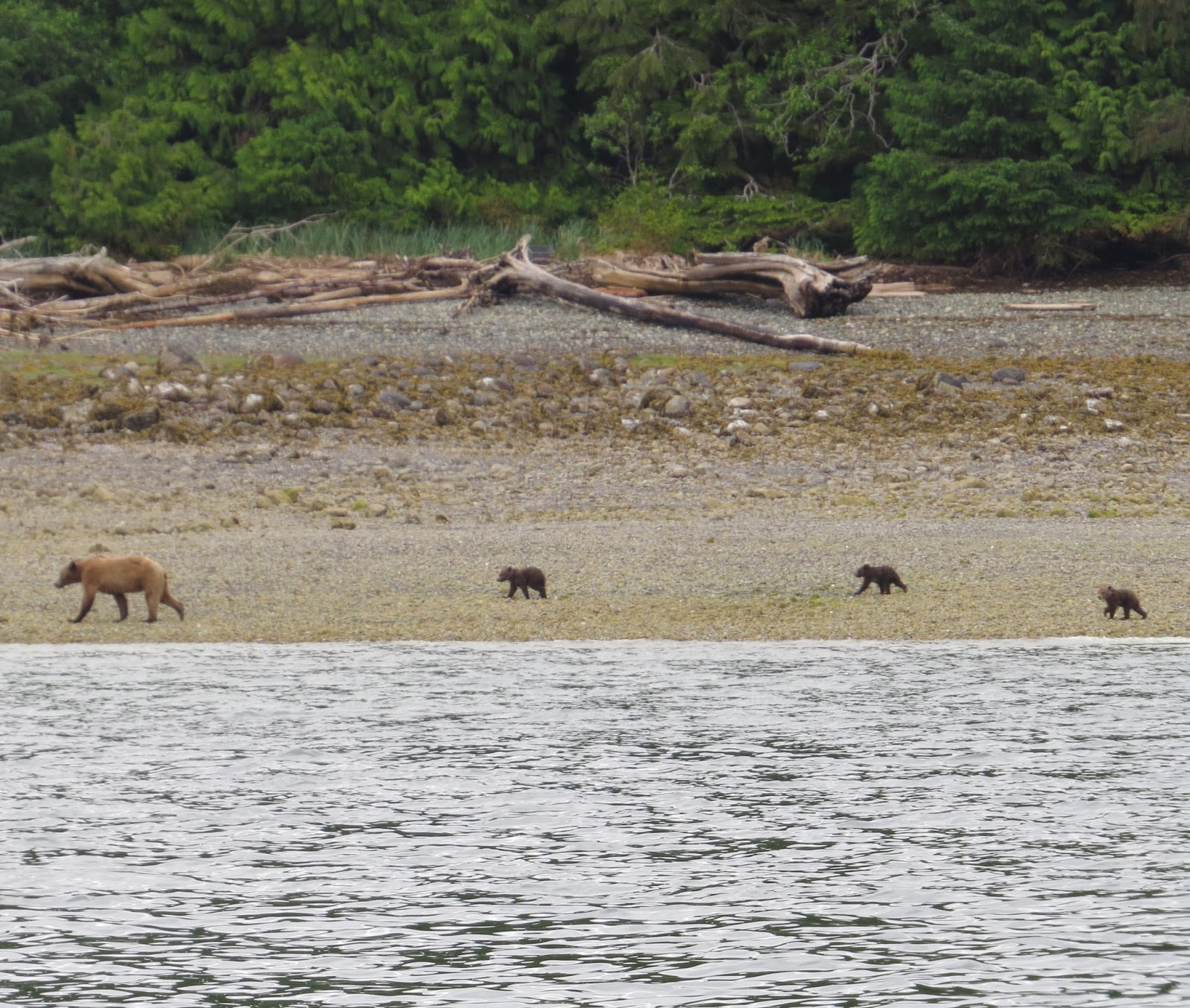
We also saw schools of white
sided dolphin (moving too quickly for me to get a photo), a mama grizzly bear
and 3 cubs at Cutler Cove estuary
 |
| Grizzly bear and cubs |
We also passed by some lovely waterfalls - huge
rockfaces to the sky.
 |
| Cliffs and the sea |
 |
| Rocks go to the skies |
Where there is
plant and tree life, it is verdant and stunning. Landslides from logging are
sometimes also evident.
 |
| Landslides, old clear cut scars |
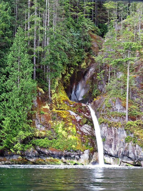
We had lunch near Cascade Falls where the captain was
able to pull the boat almost right up on shore.
 |
| Cascade Falls |
 |
| Little Falls near Cascade Falls |
Lunch was delicious - shrimp broth, ham cheese, roast
beef sandwiches. In the background we could see what I think is called the
Kennedy Glacier.
 |
| Views |
 |
| Where we pulled up in the boat and had lunch |
 |
| Kennedy Glacier, I think |
As we came back down the inlet/fjord towards
Minstrel,Village and Turnour Islands the weather began to lighten and we
actually had blue skies for a while.
We
also had a surprise fly-past by two fighter jets from the Canadian military. I suppose they may have been either training
or perhaps looking for illegal grow-ops.
The noise they made shattered the cruising calm but were swiftly by
us. A couple of minutes later they raced
back again. Wow!
On one of the little Islands, we passed a small,
apparently deserted First Nations village. Our captain gave us a bit of a
history of the First Nations in this region.
I think the village (may be called Karlukwees and was a principal
community of the Tlowitsis Nation) is located on the south shore of Turnour
Island facing Beware Passage. Many of
these villages can be recognized by large middens (shells) and protective rock
islands (to keep out marauders)
 |
| Karlukwees village |
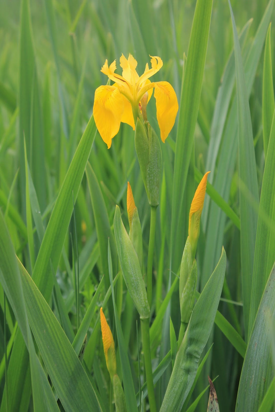
Nearby, there was some amazing rock art -
pictographs. These are usually painted
under a bit of a rock ledge (for protection).
I believe the "paint" used was made of a deep red earth, a
powder form of iron oxide traded from somewhere inland (Penticton?) mixed with
fish eggs and saliva. One of the images
could have been that of a sailing ship, others may represent story/song/dance
lost in time. They may have been 4,000
years old; they may have been 400 or closer to modern time.
 |
| Pictographs |
Another formerly deserted First Nations Village is called
New Vancouver (Tzatsisnukomi, in the Kwak'wala language), It is on Harbledown
Island and is being brought back to life again by the people who have come home
there. It is the main village of the
Da'naxda'xw subgroup of the Kwakwaka'wakw peoples.
Their hereditary chief died about 3 weeks ago
and the community is still in mourning.
His grandsons came to the dock; between them and our captain, they gave
us some further history of their grandfather, coming home to the village in the
1980s, rebuilding homes, their Big House, totems.
 |
| Tzatsisnukomi - New Van |
We arrived back in Port McNeill at about 4pm, boarded our
coach to Campbell River - a bit rainy; however, that was okay - we were on the
bus. Some of us were able to grab a bit
of a sleep on the two or so hour drive.
It had been a long day.
 |
| On the road to Campbell River |
When we
got settled at the Coast Discovery Inn, we had our dinner in their restaurant,
the DI (Discovery Inn). I had the Caesar
salad with grilled prawns - yummy.
Thursday, June 9, 2016 – A not-at-all desolate –
Desolation Sound.
We caught the 10 am ferry from Comox to Powell
River.
 |
| As we set out |
Our lunch at the Savoury Bight
Restaurant was a buffet with many types of salads, meats, etc. Quite delicious and set us up well for our
afternoon adventures.
After lunch, we drove to the end of Highway 101 at Lund
and visited Desolation Sound, British Columbia’s largest marine park. It attracts recreational boaters from around
the world because of its splendid scenery, pleasant summer climate, unusually
warm waters, numerous sheltered harbours, and the snowcapped peaks of the Coast
Mountains which rise over 8,000 feet from the water.
Once we got up to Desolation Sound, we discovered it was
not at all desolate today. We were given
a "tot" of run (cinnamon whisky) for being good seamen/women, saw
harbour seals, sea lions, eagles and pictographs.
 |
| Eagle swooping for food to feed baby |
 |
| Harbour Seals |
 |
| Pictographs |
One of my favorite sport was a little cove
protected by a somewhat rocky entrance.
 |
| Rocky entrance to comfortable little cove |
 |
| Comfortable little cove |
Others of our group did the same cruise, but in zodiacs.
 |
| One of my traveling companions in a Zodiac |
Dinner was with the group. Again, it was a buffet of more salads and
lovely roast beef, yorkshire puddings.
We stayed overnight at the oceanfront Beach Gardens Resort and, after
dinner, gazed out at the beautiful marina/harbour - we simply enjoyed the
splendid setting.
 |
| From our hotel to Texada Island |
Friday, June 10, 2016. – Soaring peaks and waterfalls.
We drove from Powell River down to the Saltery Bay ferry
terminal where we saw many, many little hummingbirds sipping away at feeders
the ferry employees put out for them.
 |
| Hummingbirds at Saltry Bay |
We
then rode the ferry across Jervis Inlet to Earls Cove. This was a day of
magnificent scenery as we explored one of British Columbia's best known fjords.
 |
| Our cabin cruiser (from Sunshine Coast Tours web site) |
Departing from Egmont in three "cabin cruisers"
(Sunshine Coast Tours), we had a bit of a soggy cruise for two hours as we
chased each other up Jervis Inlet (which divides two peninsulas - Malaspina and
Sechelt ) past soaring peaks and waterfalls that cascaded directly into the
ocean.
 |
| Views up Jervis Inlet |
 |
| Views up Jervis Inlet |
 |
| Views up Jervis Inlet |
 |
| Views up Jervis Inlet |
 |
| Malibu Princess |
 |
| Views up Jervis Inlet |
 |
| Views up Jervis Inlet |
 |
| Pictographs |
 |
| Views up Jervis Inlet |
Malibu Narrows is the location of historic Malibu Lodge,
an impressive log structure that was once an exclusive retreat for Hollywood
celebrities and is now a popular church camp.
Sadly, one of the campers had gone missing a few days earlier and the
Search and Rescue folks were out there looking for him.
 |
| Malibu Lodge and Rapids |
The person who purchased the property around Princess
Louisa Inlet in 1927, James F. MacDonald, said, when he deeded the property in
1953 to a society to protect "his" Inlet to be "preserved,
undeveloped and pristine, for all to behold her natural splendour and
majesty", he wrote "In giving my Princess Louisa Inlet property to
the boating public of the Pacific Northwest, I feel that I am completing a
trust. The head of Princess Louisa Inlet is one of the most lovely,
outstanding, spectacular beauty spots in the world. It is Yosemite Valley, the
Fjords of Norway and many other places all wrought into the background of our
conifer forests of the Pacific Northwest."
I agree with him wholeheartedly.
The narrows and tidal rapids mark the entrance to
Princess Louisa Fjord (Princess Louisa was Queen Victoria’s mother, but the
native name “Sway-oo-lat” means “facing the rising sun’s rays” ) and, from there
on, the sheer cliffs rose thousands of feet out of the water.
 |
| Princess Louisa Inlet |
 |
| Princess Louisa Inlet |
 |
| Princess Louisa Inlet |
 |
| Princess Louisa Inlet |
The vessels docked at the upper end of the fjord and we
had time ashore to admire the gorgeous verdant scenery and the thundering
cascade of Chatterbox Falls.
 |
| Chatterbox Falls |
 |
| Chatterbox Falls |
In typical
West Coast Rain Forest style, the weather had "socked in" fairly
badly and it was rain, rain, raining quite heavily. Good thing we all brought decent rain gear.
 |
| Gorgeous verdant scenery |
 |
| Gorgeous verdant scenery |
The crew prepared a lovely salmon barbecue lunch (and
salads, desserts) for us and served it "buffet" style under the
picnic shelter near the falls. It was
pretty wet but we had a very enjoyable time - we sort of got the fire started (and Lisa tried to keep it going by waving my hat over it) but the fuel was pretty soaked so the fire did not stay alight for long. Once we left the falls, the rain sort of let
up and we just had drizzle on the way back.
 |
| Dock at upper end of Princess Louisa Inlet |
 |
| Princess Louisa Inlet |
 |
| Princess Louisa Inlet |
Back at Egmont, we drove south along the Sunshine Coast
to Sechelt and stayed overnight at the Driftwood Inn on the waterfront. We had a lovely dinner at the Daphane
Restaurant. Unfortunately we did not
have a reservation and even after we were seated (about half an hour), our food
took about three quarters of an hour to arrive.
Lovely Greek food - taramasalata, keftedes and salad for me. While it was a totally unreasonable wait
(even without a reservation), the food was magnificent. Would I return - yes, I would; however, I
would make a reservation.
Saturday, June 11, 2016 - We took the ferry from
Langdale to Horseshoe Bay, then I left the tour and spent a day or so in
Vancouver visiting relatives.
I can say this was another wonderful Wells Grey Tours experience.


 Bailey’s Chute is a short walk off the road. The trail winds through a delightful
wildflower garden (bunchberry, variety of small green plants and ferns) and
ancient stands of magnificent cedars.
Bailey’s Chute is a short walk off the road. The trail winds through a delightful
wildflower garden (bunchberry, variety of small green plants and ferns) and
ancient stands of magnificent cedars. 


 Mushbowl Falls is located about 5 km by road from
Helmcken Falls. The Myrtle River drops 5
m (16 ft) here and is split by a central rock.
The waterfall is located here because of Cambrian rock which has
resisted erosion. The park road bridges
the Myrtle River at The Mushbowl via a little one-way wooden bridge. The name was given to this waterfall prior to 1940 and it is a good
description of the water's action. We were fortunate enough to catch the waterfall with a little rainbow on the left hand side.
Mushbowl Falls is located about 5 km by road from
Helmcken Falls. The Myrtle River drops 5
m (16 ft) here and is split by a central rock.
The waterfall is located here because of Cambrian rock which has
resisted erosion. The park road bridges
the Myrtle River at The Mushbowl via a little one-way wooden bridge. The name was given to this waterfall prior to 1940 and it is a good
description of the water's action. We were fortunate enough to catch the waterfall with a little rainbow on the left hand side.  Dawson Falls are located 600 m (1,969 ft) upstream
from the Mushbowl. At the falls, the
river drops over lava flows that date to about 200,000 years ago. Below the lava are compacted sand and gravel
deposits left by a river that predated the eruption.
Dawson Falls are located 600 m (1,969 ft) upstream
from the Mushbowl. At the falls, the
river drops over lava flows that date to about 200,000 years ago. Below the lava are compacted sand and gravel
deposits left by a river that predated the eruption.


